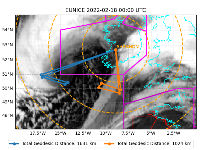
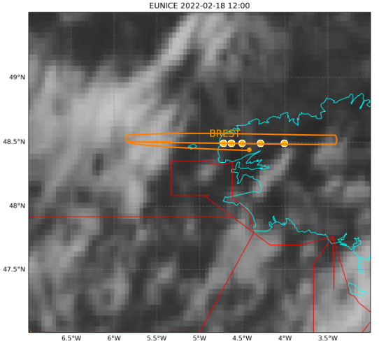
Virtual flight plans for storm Eunice overplot on MSG satellite infrared imagery on 18 Feb 2022. Left: ATR42 flights from Shannon over the cloud head (blue line) and the DI/cold front (orange line) at 00 UTC. Right: F406 flight plan (orange line) from Brest in the DI region at 12 UTC with repeated overpasses of the wind lidars of KITcube (filled orange dots). Magenta boxes indicate the flight information regions (FIR), red boxes restricted military areas, and dashed circles 250 km intervals.